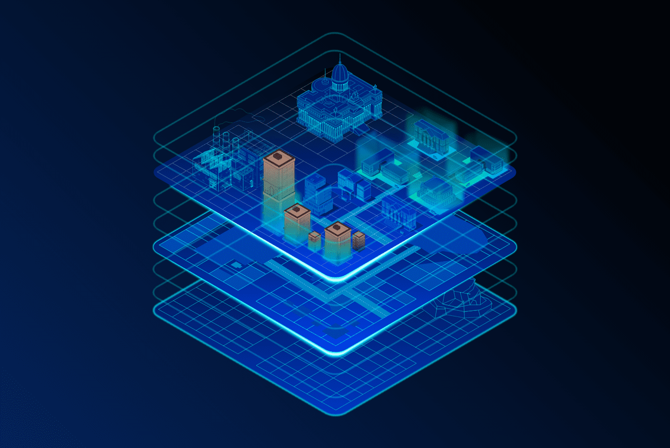
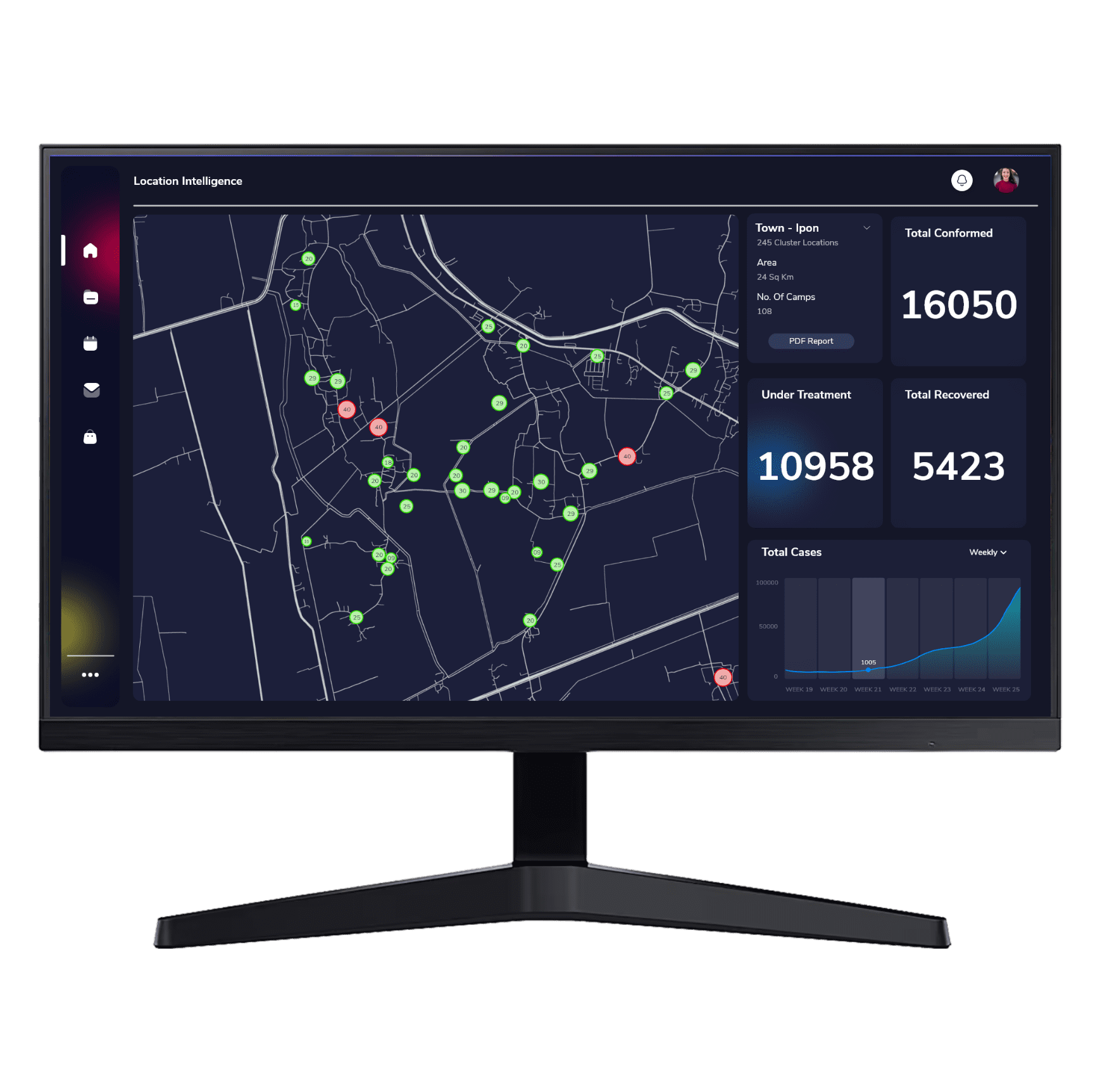
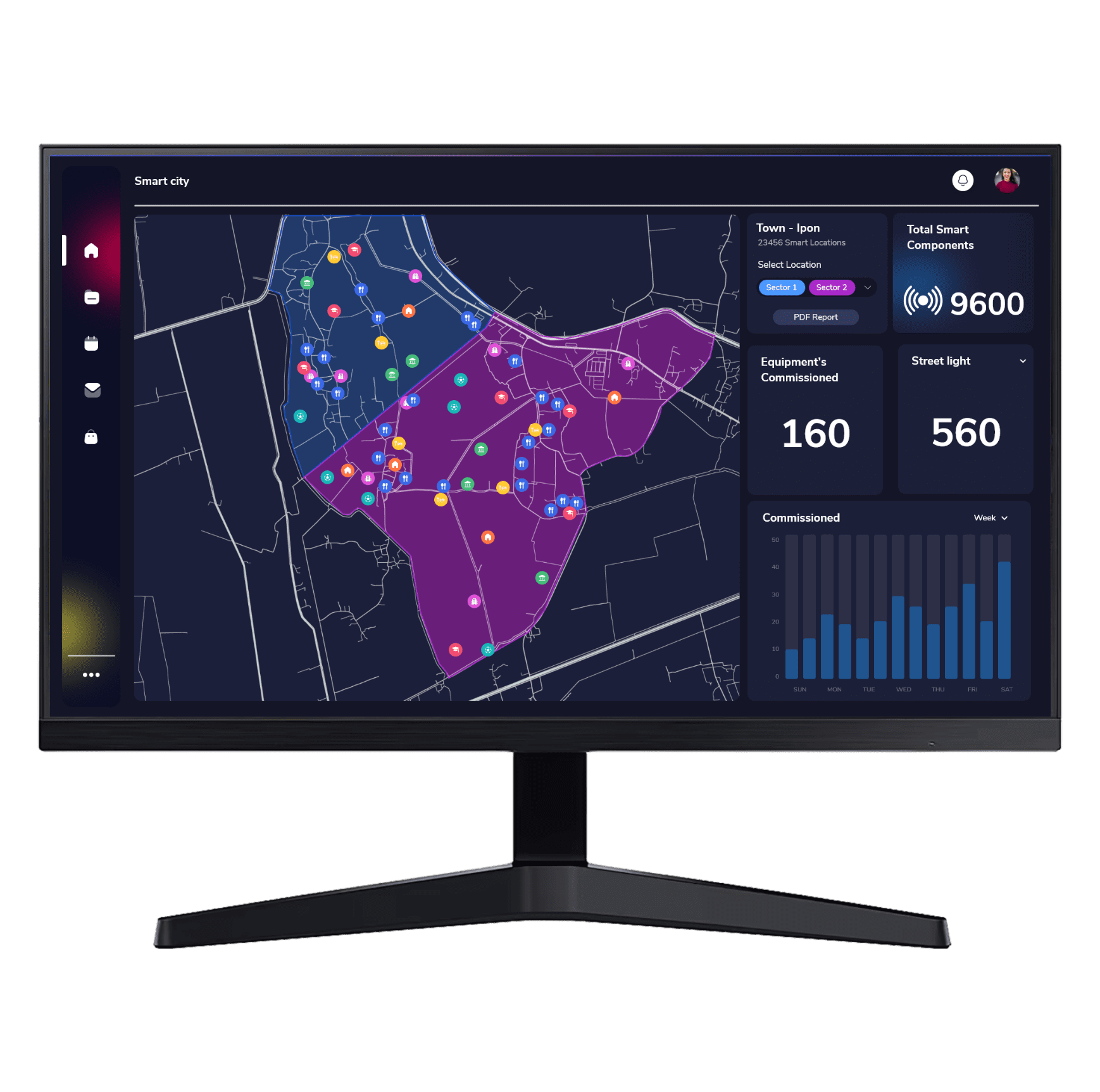
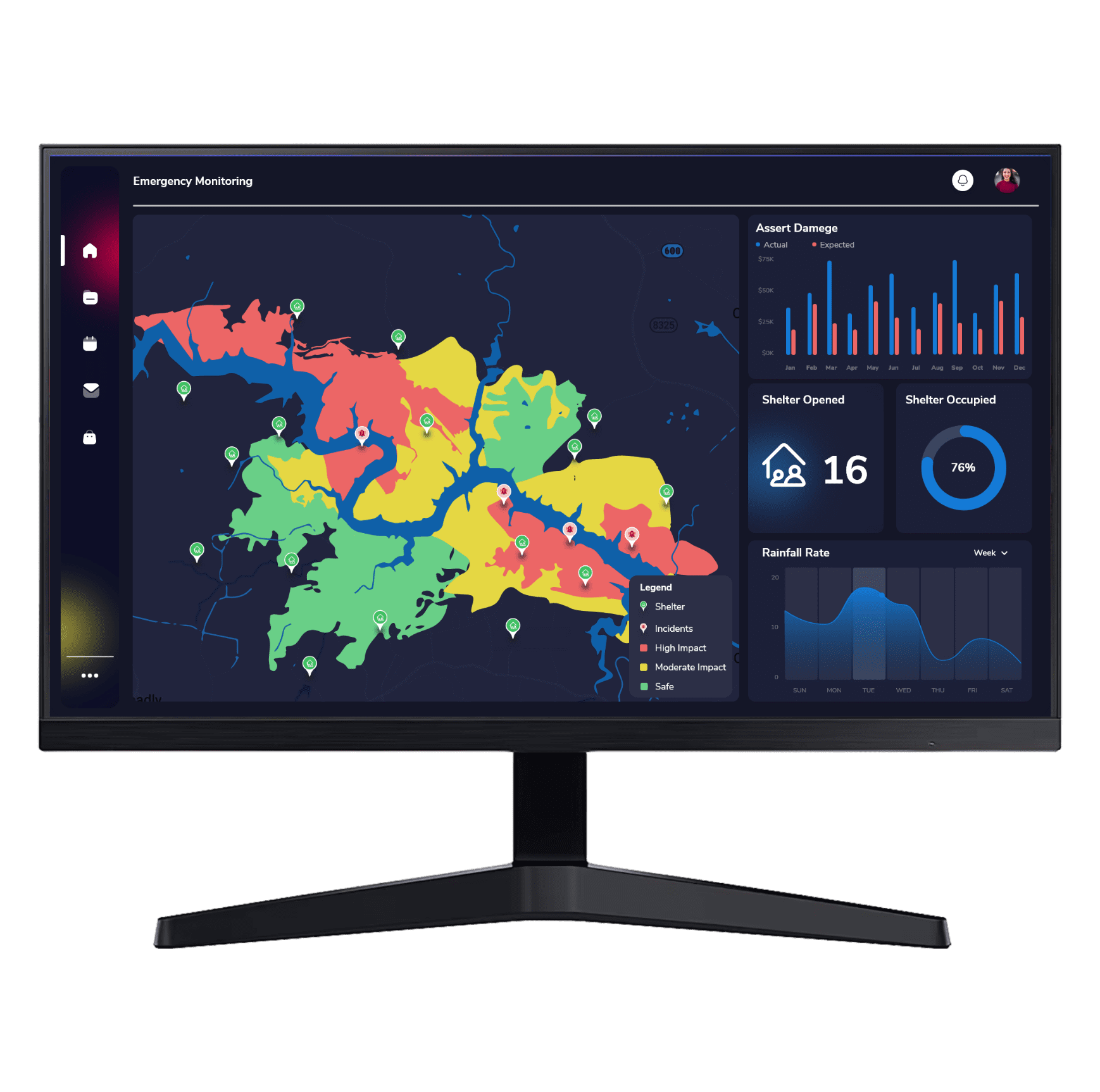
Having a virtual representation of the real world, with its natural and built environments, gives an insight to how the physical objects interact and process. GIS enables us to replicate not only the objects, but also the relationships, behaviors and processes in them. Bringing together the different types of data to a single view in GIS gives way for advanced analysis and automation of real-world processes.
Have building layer and elevation in perspective view (corner towards user) on left side. Have another layer like structure next to it on right side (initially blank). Have shiny jumpy lines between the two layers, slowly replicating to on right side