Cliffhanger Solutions is an application and service provider with an emphasis on geospatial elements and real-time enterprise data analytics. Our engineers have practical experience creating desktop and mobile apps and subject matter knowledge in GIS, inspections, data collecting, OMS, SCADA, and asset management.
Integrated Mobile Data Collection and Visualization
The Atlas Platform enables utilities and their contractors to visualize and collect information about field assets for supporting tasks such as: Vegetation Management, Pole Inspections, Outage Management and Leak Surveys.
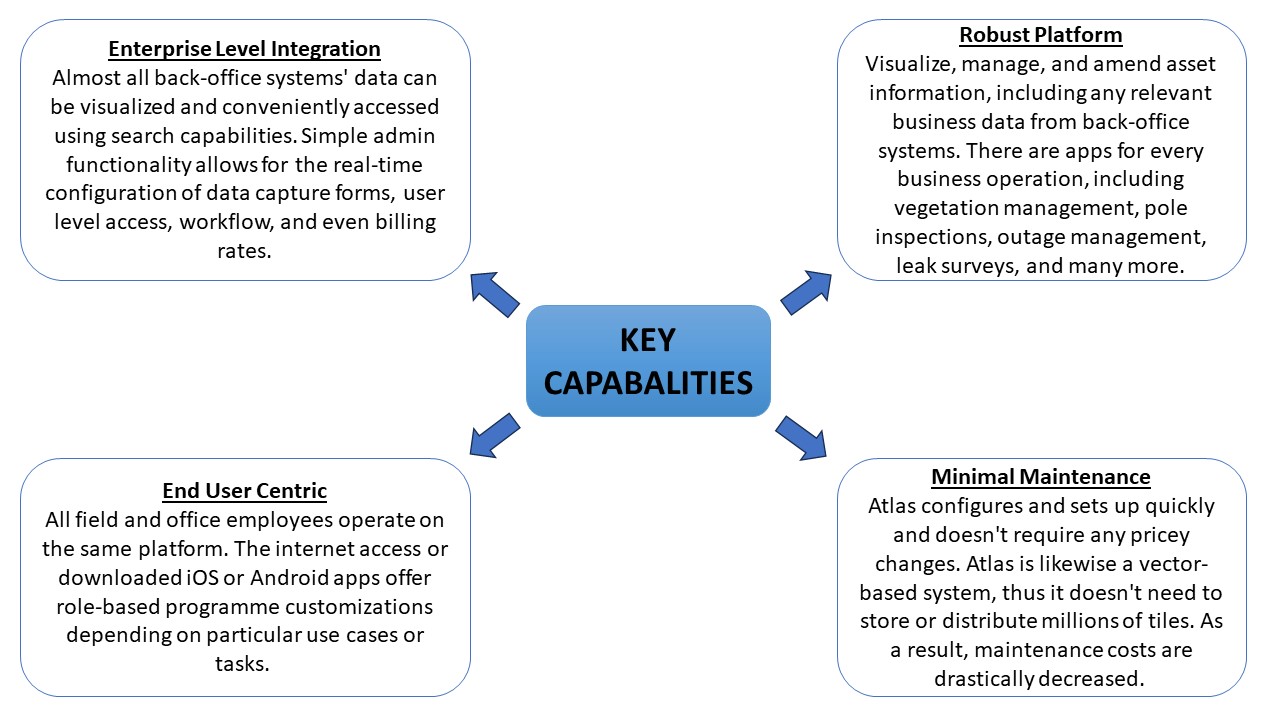
ATLAS: KEY CAPABALITIES
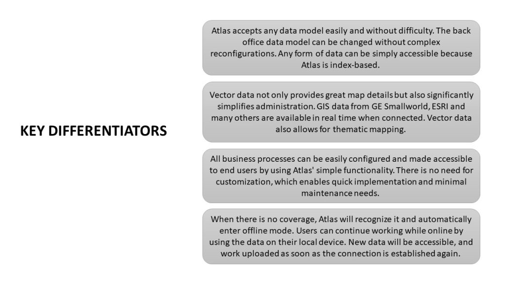
ATLAS: KEY DIFFERENTIATORS
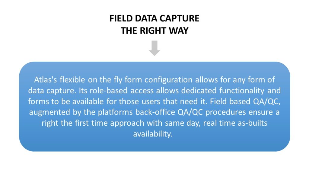
ATLAS: FUNCTIONALITY
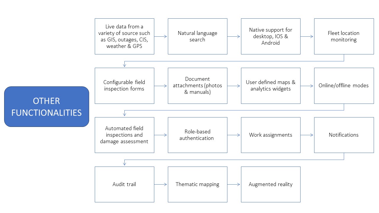
ATLAS CAPABALITIES
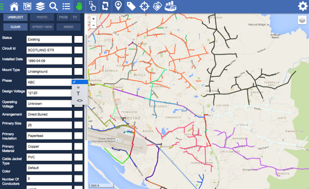
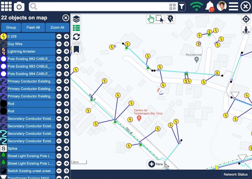
VECTOR DATA
Along with offering excellent map details, vector data also greatly streamlines administrative processes.
BACKGROUND DATA
Street, satellite or hybrid are available. Bing, google or open street map and third-party layers like weather, crime data etc can be enabled.
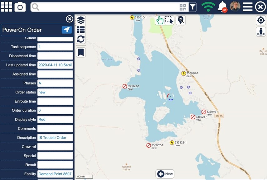
OUTAGE DATA
Live outage data available for field users.
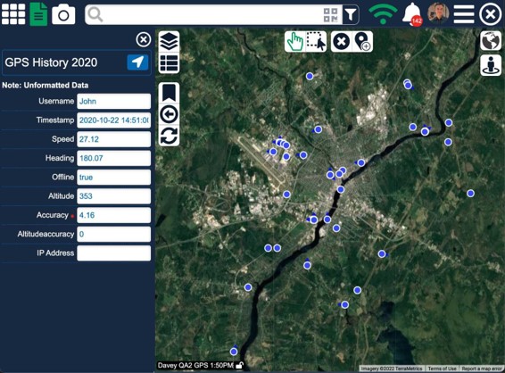
CREW LOCATION DATA
Crew locations shows on the map. Details and historical data such as bread crumbs are available.
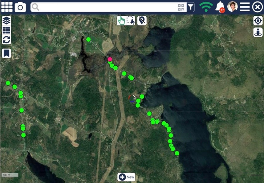
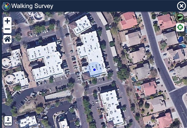
BREAD CRUMBS
Bread crumbs as shown here while doing an automated driving survey where objects are marked surveyed automatically when vehicle is within acceptable radius.
MAP ROTATION
Map can be rotated manually or automatically depending on driving or walking direction.
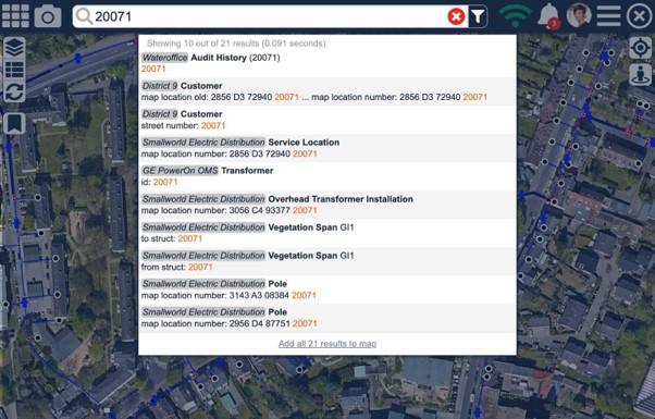
SEARCH. SIMPLE
Find anything you need without specifying what you are looking for.
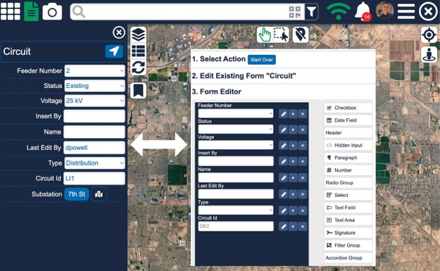
FORMS
Use drop downs, radio buttons, default values, mandatory fields, invisible fields.
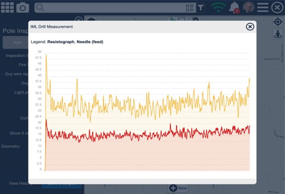
BLUETOOTH INTEGRATION
Bluetooth Integration with third party hardware such as sniffers and resistographs.
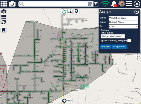
WORK ASSIGNMENTS
Define work to be done by simply selecting objects on the map, search, use trace results (level of effort) or inside a manually drawn or predefined area.
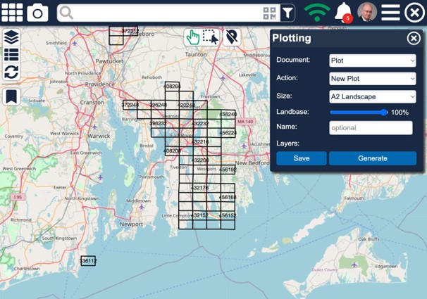
PLOTTING
Plots can be created in different sizes, preferences saved and recalled later. User receives a push notification when plot is ready for download.
PHOTOS AND ASSIGNMENTS
Photos and other type of attachments can be associated to a location on the map or associated to an asset. Clicking on the attachment icon opens the picture or document.
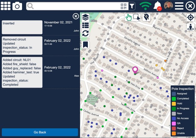
AUDIT TRAILS
Left side shows full audit trail of who did what to what asset or inspection.
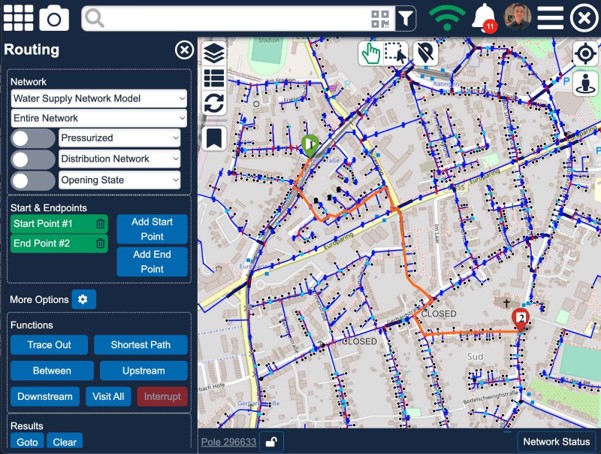
TRACING
Tracing is supported in both offline and online modes. Shortest path, upstream, downstream and stop criteria.
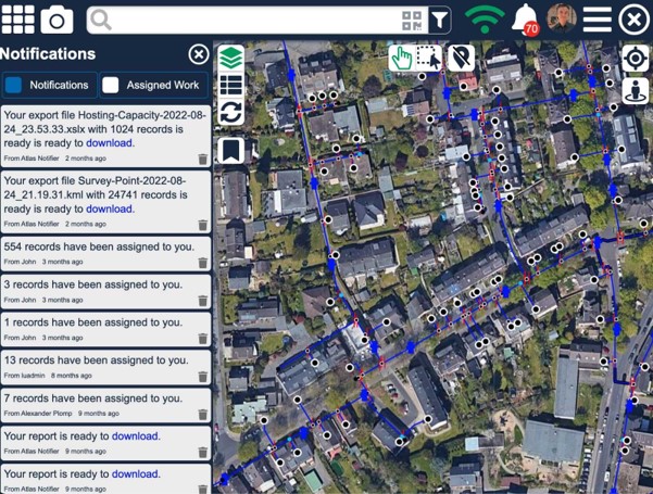
PUSH NOTIFICATIONS
User receives push notifications when work has been assigned, exports have been completed, plots are ready for download etc.
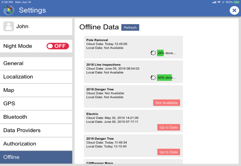
ONLINE AND OFFLINE
Offline data being loaded onto mobile device. Since the data is vector data, this process only take a very short period of time. User receives a message when new data is available for offline use, but will always have the latest data when connected.
DASHBOARD
Easy to configure dashboard allowing bar graphs, heatmaps, pie charts etc
benefits
Maintain access to your data at all times (in office and field).
Perform analytics in real time.
Avoid expensive migrations, out-of-sync data.
Break down the barriers of “black box” data silos.
Speak to us today!
Explore how GIS can help your organization solve industrial challenges. We expand more potential on your industrial data that you have within your reach.