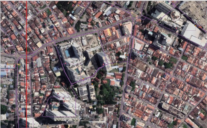
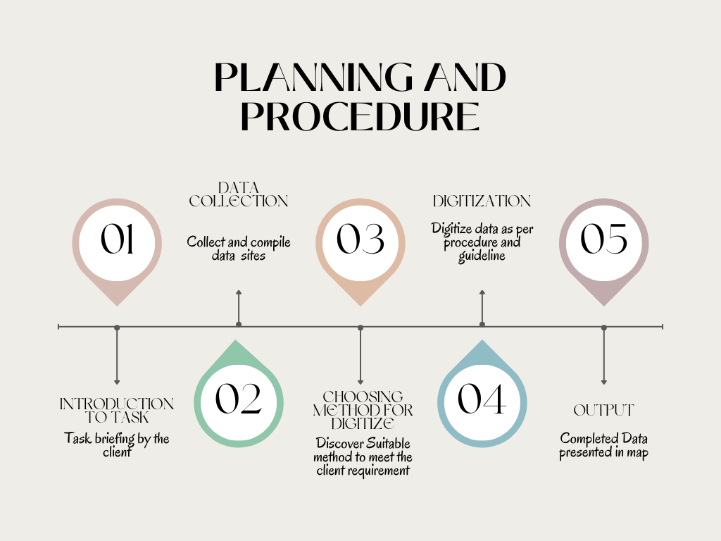
DATA DIGITIZATION

Data digitization in GIS offers several benefits, which are improving data accuracy and consistency, increasing data accessibility and sharing, and the ability to integrate various data sources for better decision-making and planning.

WHAT IS DIGITIZING?
GIS data digitization converts analog geographic information into digital formats, modernizing spatial data for diverse applications. This process enhances accessibility, usability, and versatility, facilitating informed decision-making and spatial analysis within GIS environments.

Digitization involves identifying, improving, and documenting existing workflows to streamline operations and improve efficiency.

PROCESS INVOLVED

DATA EXTRACTION

Extracting from various sources like SCADA tile images, single line diagrams, we gather asset data and spatial coordinates for digital maps.

IMAGE ACQUISITION

Acquiring base maps or image data, whether through satellite imagery or aerial photography, provides essential spatial context for digitization efforts.

PROJECTION

Utilizing georeferencing tools in GIS software, acquired images are aligned with existing georeferenced data, ensuring spatial accuracy and consistency.

DIGITIZING FEATURES

Creating digital representations of real-world objects involves tracing boundaries, delineating infrastructure networks, and outlining geographic features using specialized GIS tools.

VISUALIZATION

Completed maps or datasets are presented on client-preferred platforms, enhancing data comprehension and facilitating informed decision-making across domains.
We can bring 
Leverage 
Insight 
Efficiency 
to your business

Data-Empowered Maps: Unveiling Insights from Digitized Data

Data digitization is essential for effective visualization in GIS. By converting analog data to digital formats, it facilitates seamless integration, enabling comprehensive analysis. Digitized data empowers stakeholders to make informed decisions through visually compelling maps and charts.

PREVIOUS PROJECTS

HERE ARE SOME OF our past DIGITIZATION PROJECT

no writing (1)

Medium Voltage distribution digitization with GE smallworld

Low voltage distribution digitization Using QGIS

Thorough Planning and Route Selection

Schematic drawing of Electrical distribution network using Power On Advantage in Data Sync Manager

Speak to us today!

Explore how GIS can help your organization solve industrial challenges. We expand more potential on your industrial data that you have within your reach.