Esri is an international supplier of geographic information system (GIS) software, web GIS and geodatabase management applications. Esri uses the name ArcGIS to refer to its suite of GIS software products, which operate on desktop, server, and mobile platforms. ArcGIS also includes developer products and web services.
ESRI Developer with Professional Services
As a leading ESRI developer in Malaysia, RedPlanet Group specializes in cutting-edge Geographic Information System (GIS) solutions, presenting excellence in the geospatial industry. Our robust collaboration with ESRI Malaysia enables us to deliver comprehensive professional services, distinguished by leveraging specialized technical expertise and implementing best-practice systems. This strategic approach ensures effective location intelligence deployments and development management, meeting the highest industry standards.
Positioned as pivotal in the geospatial landscape, RedPlanet aligns seamlessly with ESRI’s internationally acclaimed GIS software, the ArcGIS platform. This collaborative synergy ensures our clients receive cutting-edge solutions, emphasizing our dedication to providing unmatched quality and innovation in each GIS project.
Applications
Esri Applications
Esri builds the leading mapping and spatial analytics software designed to support the mission and business objectives of organizations around the globe, regardless of size. Esri’s ArcGIS products run in the cloud, on mobile devices, and on desktops.The portfolio of products and services which Red Planet group cater with ESRI Stack are:
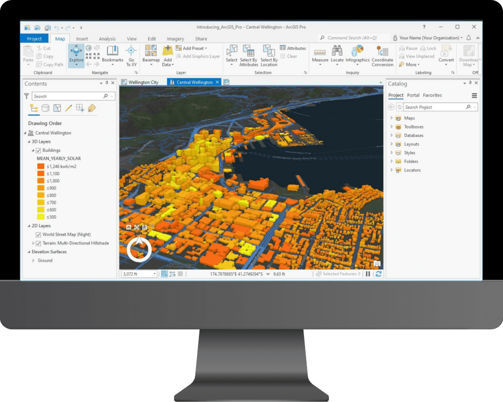
ArcGIS Pro
ArcGIS Pro is the latest professional desktop GIS application from Esri. With ArcGIS Pro, we can explore, visualize, and analyze data; create 2D maps and 3D scenes; and share work to our ArcGIS Online or ArcGIS Enterprise portal. Intutively build with modern design and ease of use.
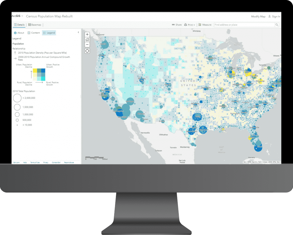
ArcGIS Online
ArcGIS Online is a cloud-based mapping and analysis solution. Use it to make maps, analyze data, and to share and collaborate. ArcGIS Online includes everything you need to create web maps, create 3D web scenes, create web apps, Dashboards and create notebooks.
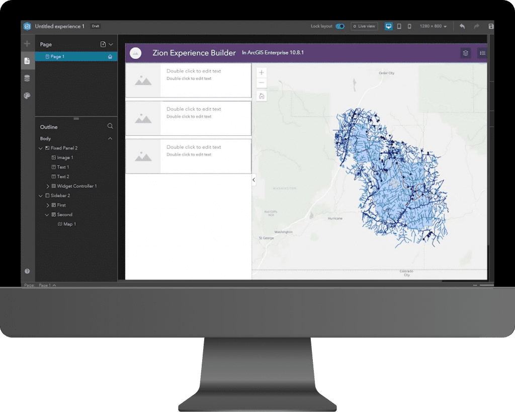
ArcGIS Enterprise
ArcGIS Enterprise is the foundational software system for GIS, powering mapping and visualization, analytics, and data management using enterprise server infrastructure. It is the backbone for running the Esri suite of applications and your own custom applications.
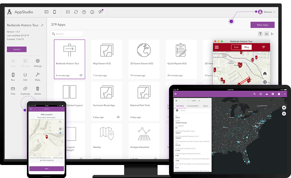
ArcGIS Mobile
ArcGIS Mobile is a geographic information system (GIS) software platform that enables organizations to deliver GIS data and services from centralized servers, providing real-time access to information over wireless networks to a range of Windows Mobile devices.
Solutions With Esri
Utility
ESRI provides stack of solutions which aids Utility sector in managing their assets and network with ease. ArcGIS Utility Network is designed to be the next generation spatial information system to provide greater functionality over massive datasets at every scale of resolution.
Finance
Fintech uses location intelligence to visualize and analyze business and community growth potential, combining data about demographics, lifestyle, and spending. ArcGIS Business Analyst provides the perfect set of tools in turning any business into scaling better height through location awareness.
Agriculture
From soil suitability to crop conditions, continuous monitoring using field apps can aid in increasing efficiency, quality, sustainability and profitability in agriculture. Precision Agriculture using Drone and AI Powered GIS has long been a silent partner in Green Technology Revolution.
Smart City
Sustainable and smarter city planning and designing is evolving across the Globe. Geo-Data sharing using ESRI ArcGIS Enterprise is gearing up the Goals of smart city by making the technology reach every citizen and every departments.
Defence
Simulations and Strategic planning being the key elements in Defence. ESRI solutions provide them with a one step ahead approach in Emergency planning to Rescue management with variety of integration connectivity from sensors to devices.
Transportation
ESRI offers variety of tools in Network based analysis. Rapid emergence in logistics and delivery platforms requires a robust Geospatial Intelligence. ArcGIS Network Analyst tools are best suited for Intelligent Mobility solutions.
benefits
Flexible and Dynamic GIS Management
Empowering businesses to gain competitive advantage with location intelligence
Integrate with other systems at ease.
*Contents and images on this page are used from www.esri.com
Speak to us today!
Explore how GIS can help your organization solve industrial challenges. We expand more potential on your industrial data that you have within your reach.