Hexagon GIS Software: Optimize Performance and Drive Business Success
Hexagon (previously Intergraph) has a rich history of 40 years in the GIS industry. Hexagon GIS software is a global leader in digital reality solutions, combining sensor, software and autonomous technologies. Their chief geospatial product, GeoMedia, has been perfected over time to solve niche problems of users. Hexagon solution also provides an array of products focusing on the particular geospatial domain, from image processing to photogrammetry.
Hexagon’s commitment to innovation extends to domains like smart cities and agriculture. Their smart city solutions leverage geospatial technologies to create sustainable and efficient urban environments. By integrating data from various sources and providing real-time insights, Hexagon enables cities to improve infrastructure management, enhance public services, and foster citizen engagement. Aside from smart cities, Hexagon’s solutions for agriculture offer specialized tools and capabilities to support precision farming, crop monitoring, and resource optimization. By utilizing geospatial data, producers can make decisions based on data, optimize yields, and promote sustainable agricultural practices.
Applications
Hexagon Applications
Hexagon’s Geosystems division provides a comprehensive portfolio of digital solutions that capture, measure, and visualise the physical world and enable data-driven transformation across industry ecosystems.
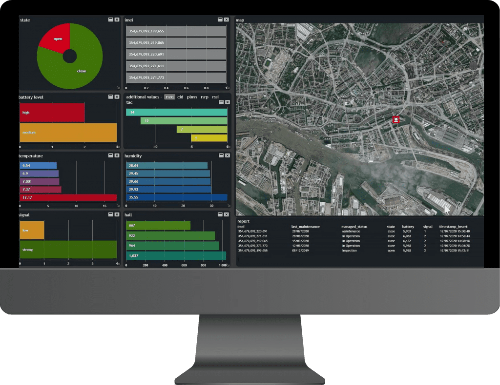
M.App Enterprise
This cloud-based platform can build geospatial apps that can be used organization wide. Integrating sensors and data of various formats can be easily set up to monitor and visualize in interactive dashboards.
Luciad Portfolio
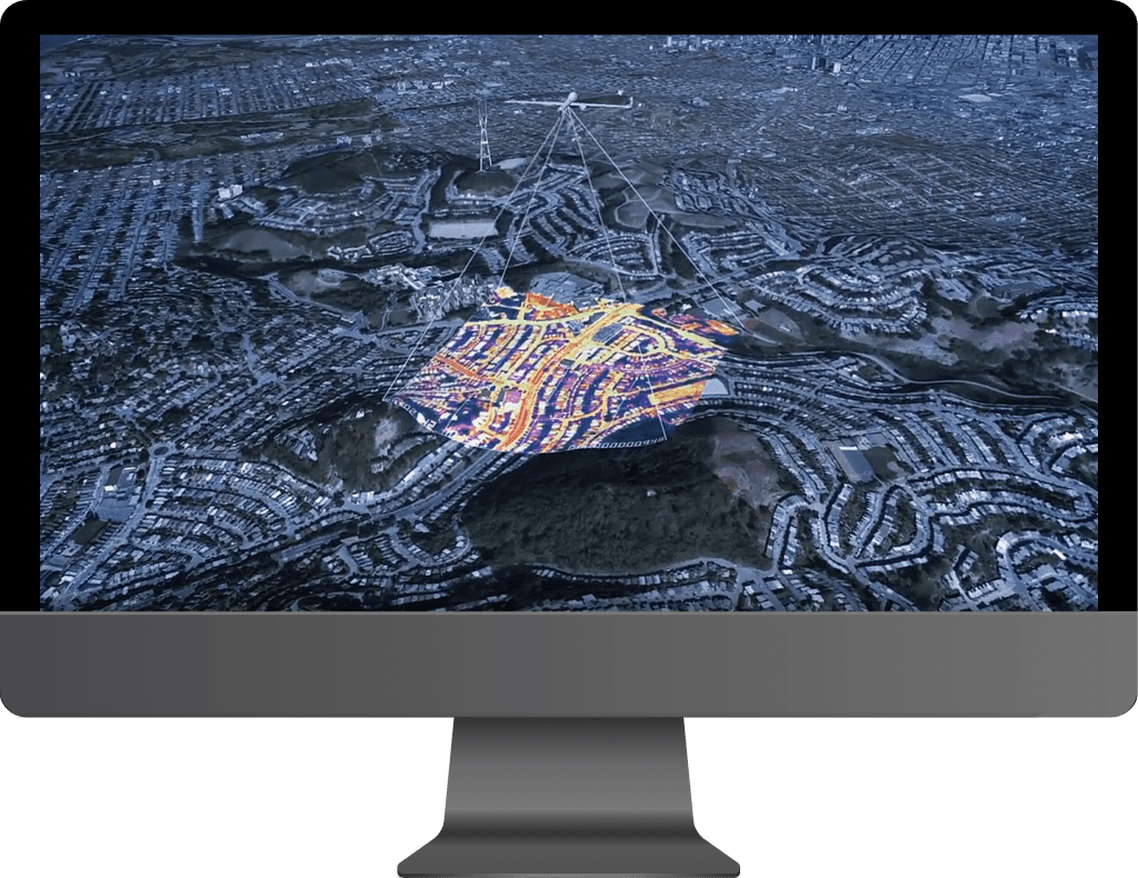
To build custom applications with real-time intelligence and situational awareness, Hexagon provides a platform to leverage the performance of devices while visualizing data with the highest accuracy.
A city with its complex plan in GIS paves way for an integrated way to ensure public safety and tackle issues in real-time. It provides an encompassing view of the city’s activities to governments and citizens, enabling a high quality of life.
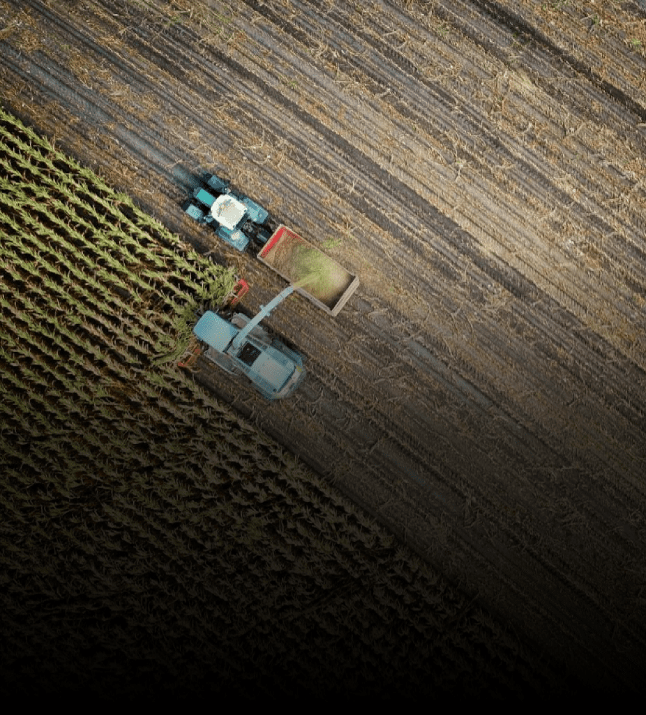
From soil suitability to crop conditions, continuous monitoring can aid in increasing quality and production in agriculture. Precision Agriculture using Drone and AI Powered decision making are game changers in Agri Industry.
Easily unlock and understand the dynamic stream of real-world geospatial information that flows through your organisation
Create intelligent, intuitive maps, and unleash the information locked in your data, making it easier to take informed, smarter decision
*Contents and images on this page are used from www.hexagon.com
Speak to us today!
Explore how GIS can help your organization solve industrial challenges. We expand more potential on your industrial data that you have within your reach.