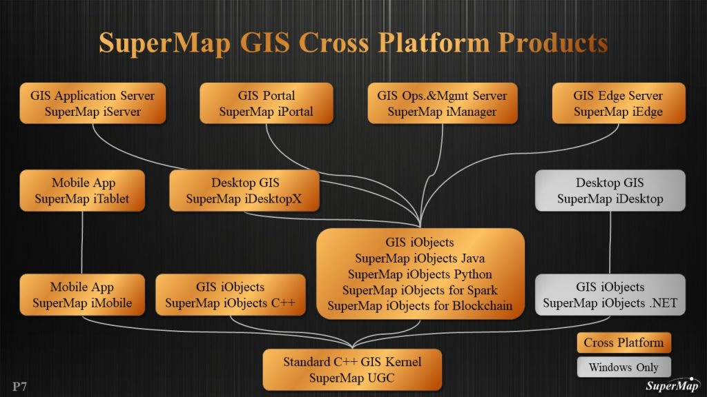
SuperMap GIS is developed by SuperMap Software Co., Ltd. It is a complete set of GIS platform software, with capabilities for producing, processing, and managing spatial data on desktop, service, component, and mobile GIS platforms. SuperMap GIS has developed a good GIS software brand with full angles and strong functions that can meet different requirements for a wide range of industries, and it has been deeply applied in every GIS industry in China, inspiring a significant number of secondary development companies. This has been accomplished through continuous technological innovation, market exploration, and experience accumulation.
SuperMap Partnership in Malaysia
RedPlanet Group, in collaboration with SuperMap, drives geospatial technology advancements in Malaysia. Leveraging SuperMap’s global GIS software expertise, we significantly boost the nation’s geospatial sector. As a cutting-edge GIS platform provider, we align seamlessly with SuperMap’s commitment to technological progress, focusing on delivering state-of-the-art spatial data processing solutions.
Our impact extends to a dedicated website released in 2015, emphasizing local engagement and addressing community geospatial needs. Pivotal in the SuperMap Distributor Program, we support local distributors, enhancing the landscape with competitive GIS products and fostering opportunities for aspiring businesses. In synergy with SuperMap, we lead in empowering Malaysian communities through spatial information dissemination, contributing to the evolution of intelligent cities.
SuperMap Main Key Technologies
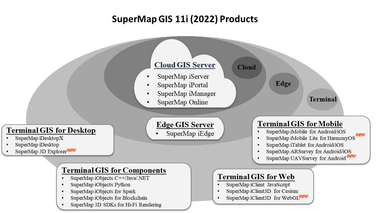
In SuperMap GIS 11i(2022), SuperMap further innovates the five technology systems of GIS platform software (BitDC). They are big data GIS, AI(artificial intelligence) GIS, new 3D GIS, distributed GIS and cross platform GIS.
Big Data GIS
Ai GIS
3D GIS
Distributed GIS
Cross Platform GIS
BIG DATA GIS
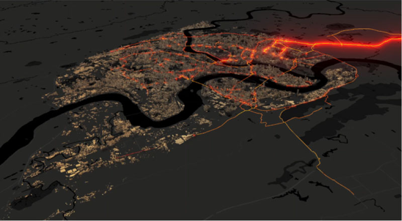
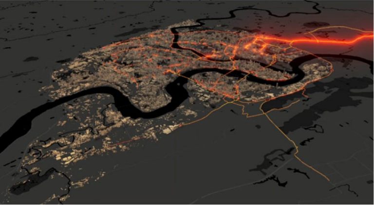
BIG DATA GIS The big data GIS system offers features for managing and storing large amounts of geographic data as well as for spatial analysis, streaming data processing, and data visualization. It is committed to offering complete support for big data GIS infrastructure software and services.
AI GIS
AI GIS Enhances the intelligence of GIS software and improves the functionality and interactive user experience of GIS software based on AI technology.
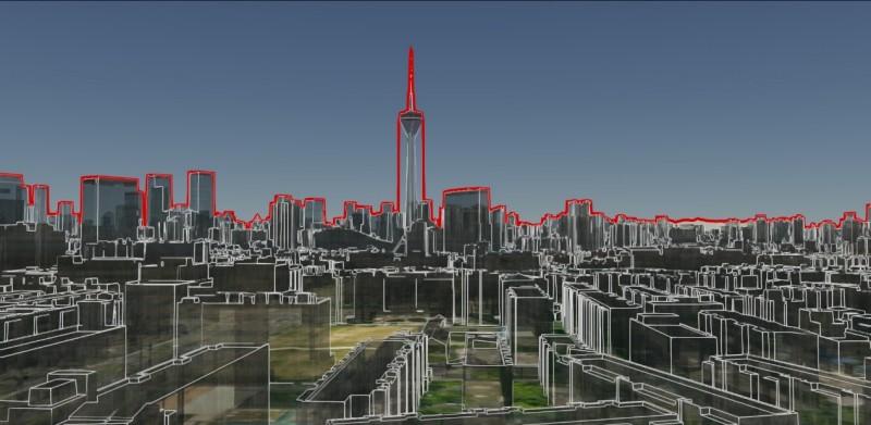
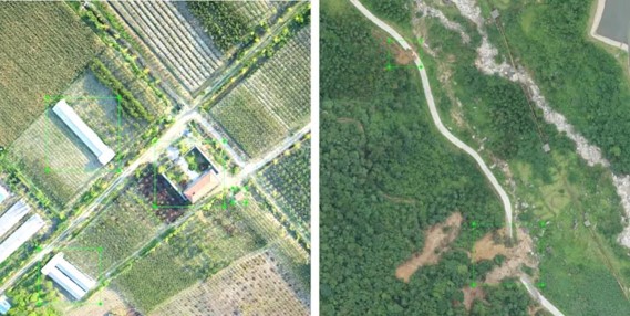
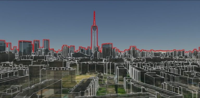
THREE DIMENSION GIS
Distributed processing automation technologies enable effective whole-process management of 3D data, including manual modelling data, BIM, real 3D models, point clouds, and terrain.
DISTRIBUTED GIS
It supports the storage, management, analysis, processing, visualization, and publication of huge quantities of both standard and big geospatial data.
CROSS PLATFORM GIS
Supports multiple CPU architectures, operation systems and database.
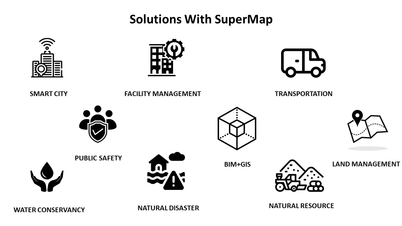
Solutions With SuperMap
Smart City
The construction of smart cities has entered a new stage of pragmatic development with innovative technologies. To integrate the complex data and information, it requires the acquisition and usage of spatial geographic information.
Facility Management
SuperMap Facility Management System can be used to develop specific applications such as railway, road and transportation facility, electricity, communication, water supply and drainage, heating supply and gas supply pipe facility system, as well as comprehensive facility management system.
Transportations
GIS has powerful traffic information services and management functions, which can be applied to all aspects of traffic management. When compared with the traditional methods, the application of GIS technology has unparalleled advantages in transportation planning, traffic construction and traffic management and related issues.
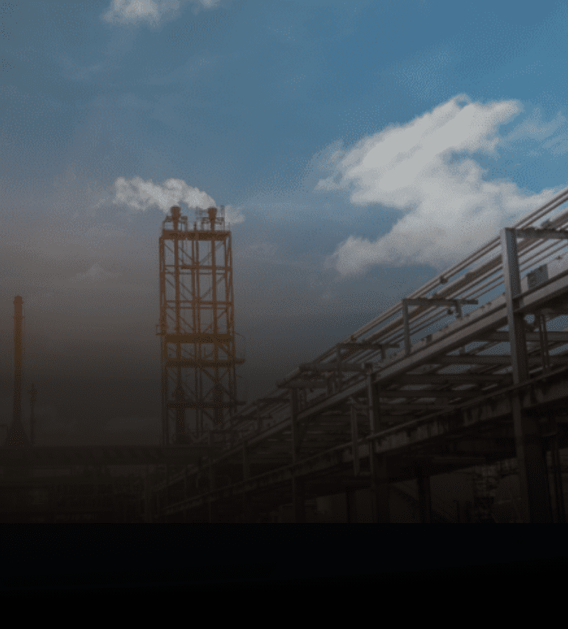
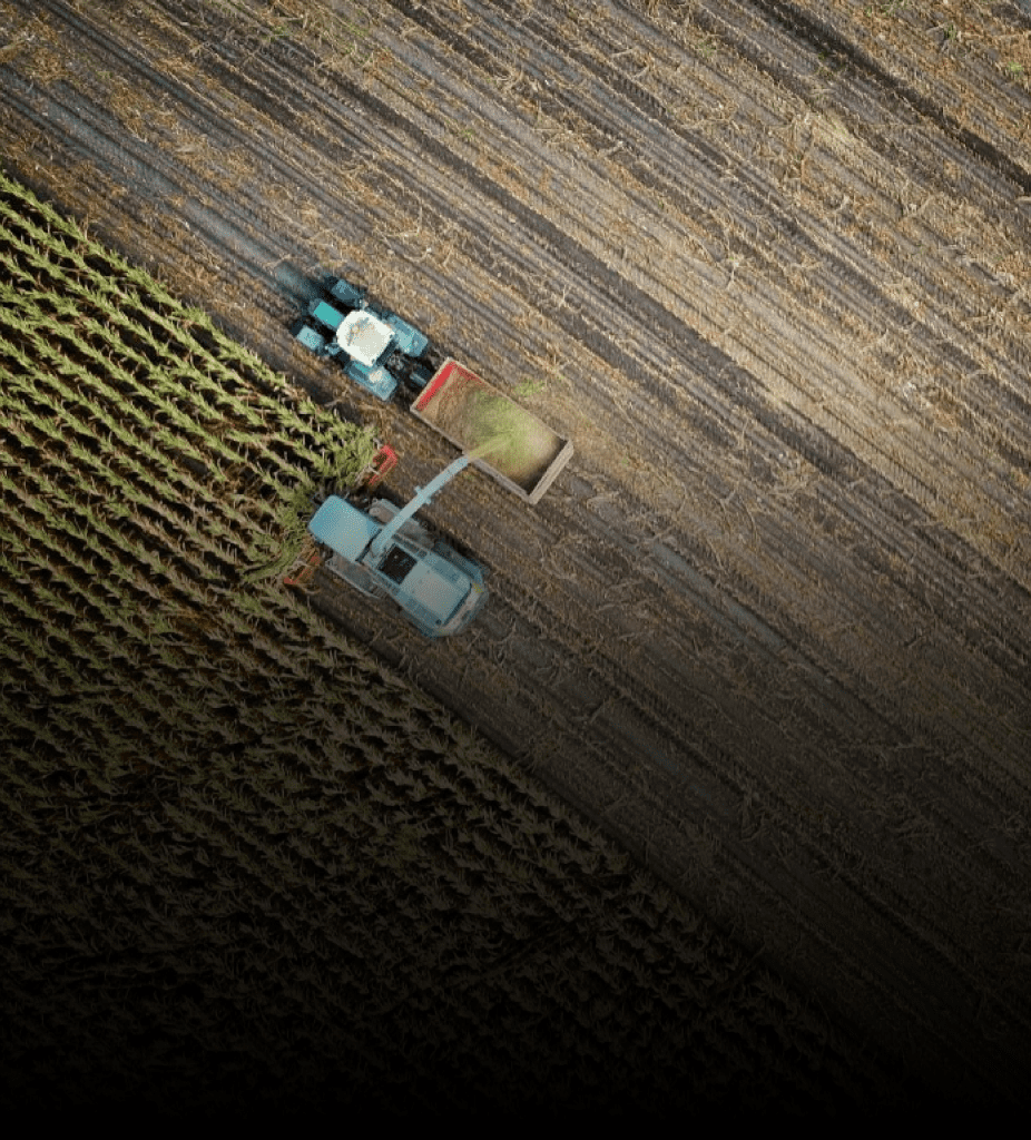
Natural Resources
SuperMap explores the theory of natural resources informatization construction, combines the key issues of natural resources and provides new methods and new ideas in natural resources informatization with advanced technologies, such as, spatial big data, 3D GIS, and AI
Public Safety
Modern Emergency Response Management Systems aims to improve government capabilities to protect public lives and property, to safeguard national security and social stability, as well as to promote economic and social comprehensive, coordinated and sustainable development.
Water Conservancy
Water conservancy informatization construction is an important method to enhance and innovate water conservancy work, also is an important driving force for water conservancy reform and development
Land Management
SuperMap focuses on the innovation and application of new technologies in the land industry with over 20-year project experience. In face of the new business needs of the land industry, a set of land solutions are formed. It involves in land survey, information management and application, monitoring and inspection.
Natural Disaster
Natural disasters bring harm to human survival or damage human living environment. SuperMap supports disaster data reporting, disaster collection task management, on-site data collection and reporting, disaster assessment, comprehensive disaster information publishing service, disaster information query and sharing.
BIM + GIS
BIM is used to manage the entire life cycle of a building, GIS is used to manage the information about the external environment of a building. Currently, BIM+GIS has been applied to bridges, pipeline, buildings, roads, dams, tunnels constructions and other fields.
benefits
Flexible and Dynamic GIS Management
Empowering businesses to gain competitive advantage with location intelligence
Integrate with other systems at ease.
*Contents and images on this page are used from www.supermap.com
Speak to us today!
Explore how GIS can help your organization solve industrial challenges. We expand more potential on your industrial data that you have within your reach.